 English
 Español
 Deutsch
 日本語
 Italiano
 Português
 Русский
 简体中文
 한국어
 Polski
 ภาษาไทย
Venezuela lies on the northern coast of South America, with Caracas as its capital. Venezuela tourist attractions range from the city's modernist architecture to Caribbean mangroves, Andean lakes and the sheer walls of the Guiana Highlands. A historic city centre, a marine national park and a remote waterfall require different arrangements. This guide groups 25 places by region.
Information was checked on 5 November 2026. This is a guide to the country's landscapes and cultural heritage; current official travel warnings place substantial limits on tourism and must come before any itinerary.
Before planning a trip to Venezuela
Check your government's advice first.
At the time of checking, Australia's Smartraveller advised against travel to Venezuela. The UK FCDO advised against all but essential travel to most of the country, with stronger warnings for Amazonas, specified mining areas and border zones. US advice was to reconsider travel, with additional areas designated Do Not Travel, including rural Bolívar and Aragua outside Maracay. These warnings differ by nationality and region; insurance and consular assistance may also be affected.
Flights and transfers need individual confirmation.
According to the FCDO, Maiquetía Simón Bolívar Airport, serving Caracas, resumed commercial operations on 1 September following the June earthquakes, with limited capacity. Arrange a trusted airport collection and reconfirm domestic flights before committing to accommodation elsewhere.
Opening arrangements and fees:
current official visitor timetables and admission prices could not be established for the places below. Earlier descriptions and reopening announcements do not establish present accessibility. Confirm entry, permits and transport with the responsible institution or licensed operator. The official currency is the bolívar; some businesses also accept US dollars. International cards and cash machines are not a dependable sole payment method, so establish payment arrangements in advance.
Weather varies by region.
Flooding and landslides can disrupt the Andes and lowland roads during heavy rains. Water levels affect river-based plans in Canaima, while highland conditions differ from those on the Caribbean coast. There is no single season that guarantees good conditions across all these destinations. The regional groups below are alternatives, rather than consecutive stages of a short national tour.
Caracas: architecture, history and the mountain skyline
4 places
1. Ciudad Universitaria de Caracas
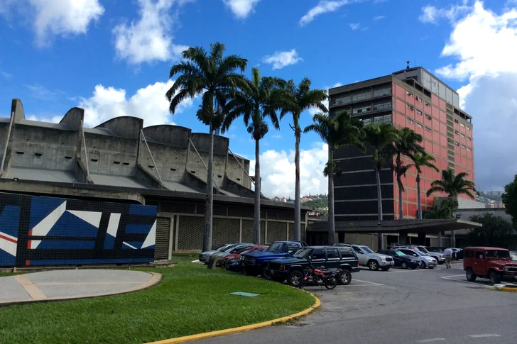
Carlos Raúl Villanueva's campus for the Central University of Venezuela brings modernist architecture, artworks and landscaped spaces into one composition. Built between 1940 and 1960, the ensemble includes the covered Plaza Cubierta, the Olympic Stadium and the Aula Magna. Inside the auditorium, Alexander Calder's acoustic Clouds combine sculpture with the practical task of controlling sound. The campus is a UNESCO World Heritage property; ask the university about visitor entry and separate access to the auditorium.
2. Plaza Bolívar, Caracas
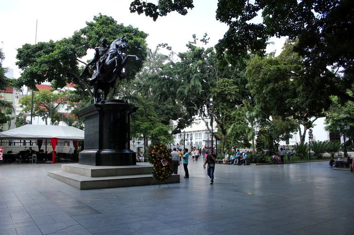
The former Plaza Mayor centres on an equestrian statue of Simón Bolívar, installed in 1874. The surrounding colonial buildings and paved streets place it within the older Caracas streetscape. There is also an invisible detail beneath the monument: the Ministry of Tourism records a time capsule under its base, deposited during Antonio Guzmán Blanco's presidency with an inventory of objects from nineteenth-century Caracas.
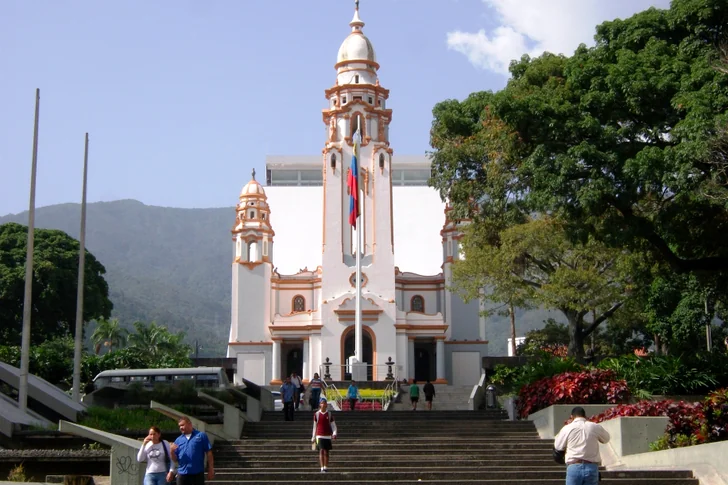
3. National Pantheon
The former Santísima Trinidad church became the National Pantheon, a memorial to national figures containing works by the painter Tito Salas. Bolívar's remains were transferred here in 1876, but his sarcophagus is now in the modern mausoleum behind the historic building, opened in 2013. The old church and the extension are distinct parts of the memorial complex. Confirm which interiors are accessible when arranging a visit.
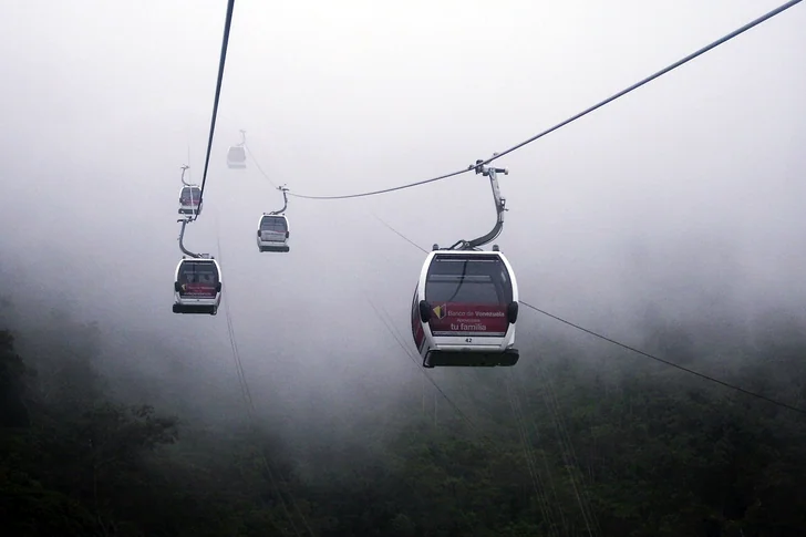
4. Waraira Repano (El Ávila)
Waraira Repano separates the Caracas valley from the Caribbean coast, with cloud forest above the city and views toward both urban Caracas and the sea. INPARQUES identifies the Sabas Nieves route, the cable car and the upper area around Hotel Humboldt among its attractions. These offer different perspectives on the same mountain range, from forest vegetation to the panorama above it. Cable-car operation and permitted park access need confirmation before choosing an excursion.
Aragua: cloud forest and the coast
2 places
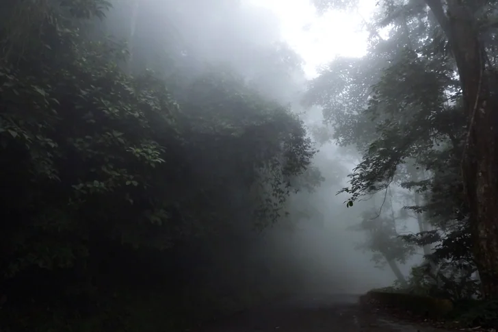
5. Henri Pittier National Park
Venezuela's first national park was established as Rancho Grande in 1937 and later renamed Henri Pittier. It protects a transition from humid mountain forest to coastal valleys in Aragua and Carabobo. Paso Portachuelo is a mountain pass associated with bird migration; on the coastal side, the landscape opens toward Choroní and Bahía de Cata. Forested slopes and the sea belong to the same protected landscape here, unlike the largely marine setting of Los Roques.
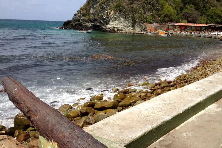
6. Puerto Colombia (Choroní)
Puerto Colombia is a coastal settlement in the Choroní area, with a malecón associated with local music and religious traditions. Ministry of Culture accounts describe Choroní's May Cross celebrations on the waterfront, while tourism bulletins record San Juan festivities in Puerto Colombia. These traditions provide a cultural context for the shore and the nearby Playa Grande beach. They are part of the area's heritage, rather than a confirmed calendar of events for a future visit.
Falcón: earthen buildings, dunes and coastal ecosystems
3 places
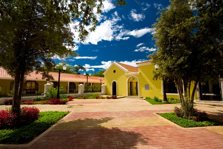
7. Historic centre of Coro
Coro's earthen architecture combines local building traditions with Spanish Mudéjar and Dutch influences. UNESCO identifies several construction techniques: adobe bricks, rammed earth known as tapia, and bahareque, which uses an earth-covered framework. The surviving street plan and buildings form an ensemble shared with the separate port of La Vela. Its conservation remains a central concern: UNESCO has placed Coro and its Port on the World Heritage in Danger list.
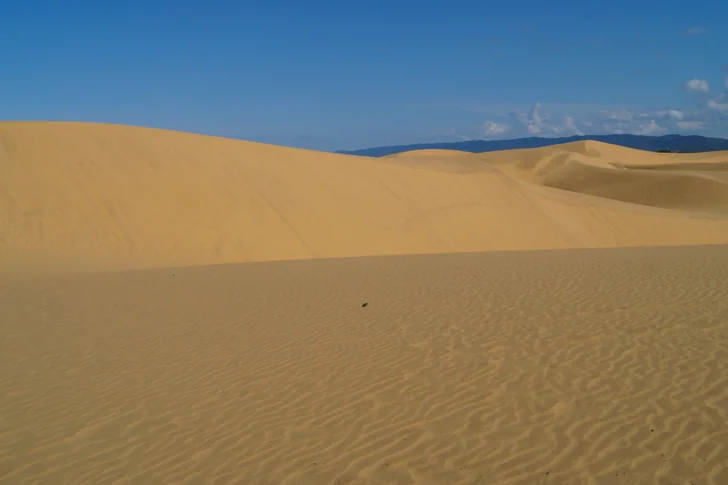
8. Médanos de Coro National Park
Close to Coro, the national park's dunes replace the city's earthen walls with exposed sand. Wind moves the grains and reshapes the dunes, so their outlines are part of an active landscape. UNESCO locates the historic city between the Médanos and the Sierra de San Luis, placing this sandy terrain within the wider geography of the heritage town. Consider the park a separate local outing rather than assuming a walk from the centre.
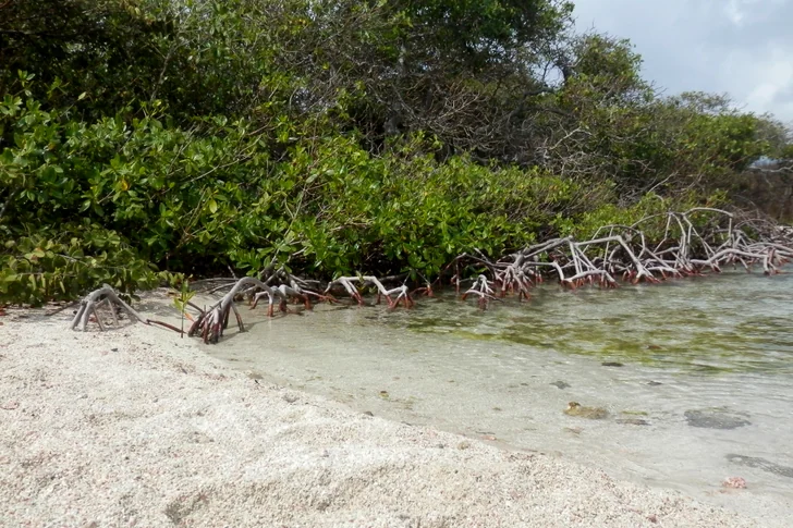
9. Morrocoy National Park
Morrocoy combines sandy cays, coral formations and mangrove channels along the Falcón coast. Cayo Sombrero is known for beaches bordered by palms, while red mangroves form shaded channels and nursery habitat for young fish and crustaceans. The park also reaches the mainland limestone terrain of Cerro Chichiriviche. When comparing a proposed boat excursion, check which part of this varied coastal system it actually covers and which destinations are permitted.
Caribbean islands: Los Roques and Margarita
4 places
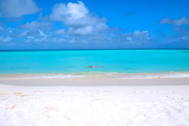
10. Los Roques Archipelago National Park
Los Roques is a Caribbean archipelago of low sandy islands, reefs, shallow lagoons and seagrass beds. Shell and coral fragments contribute to its pale sand, while mangroves and small bays add other habitats around the islands. Gran Roque provides the inhabited focal point and visible elevation amid the low marine landscape. The archipelago is a separate destination from Margarita, requiring its own confirmed transport and park arrangements.
11. Santa Rosa Castle, La Asunción
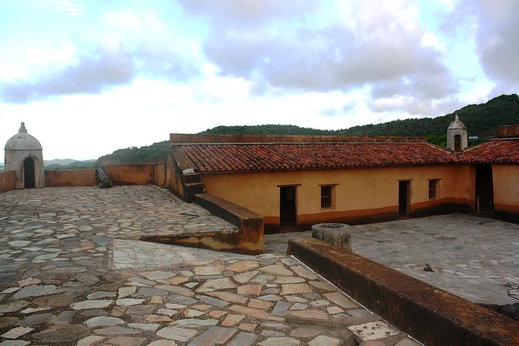
Santa Rosa Castle guarded La Asunción against pirate attacks and later became associated with the imprisonment of Luisa Cáceres de Arismendi, a figure of Venezuela's independence history. The Ministry of Culture describes its surviving original walls, exhibition rooms and panoramic views. This fortified site adds historical context to Margarita's beaches and lagoons. Ask about access to the rooms and walls before planning a visit inside.
12. Laguna de La Restinga National Park
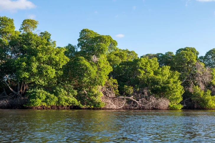
La Restinga protects a lagoon-and-mangrove environment on Margarita. Sheltered water and mangrove vegetation distinguish it from the island's open beachfront: the landscape is organised around a wetland system, rather than a strip of sand facing the sea. INPARQUES identifies these mangroves among Venezuela's internationally recognised Ramsar wetlands. For a guided visit, the main interest is the lagoon habitat itself; a particular wildlife sighting should not be the basis of the plan.
13. Playa El Agua
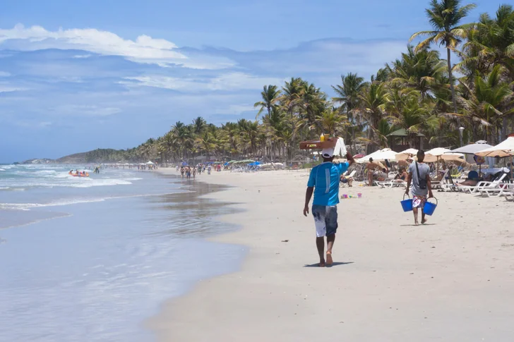
Playa El Agua, in Margarita's Antolín del Campo municipality, represents the island's open beach landscape. A waterfront boulevard opened in December 2024, with pedestrian space, sports facilities and a cycleway described by the Ministry of Tourism. The beach and its developed frontage contrast with the protected mangrove setting of La Restinga. Check current local instructions and conditions before entering the water; this description does not imply calm seas or supervised swimming.
The northeast: coastal bays and a cave ecosystem
2 places
14. Mochima National Park
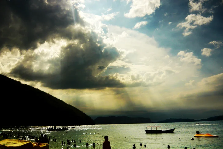
Spanning the coast of Anzoátegui and Sucre, Mochima protects a deeply indented system of bays, islands and beaches. Mangroves and coral reefs add habitats at the water's edge and below its surface. Compared with the low offshore islands of Los Roques, the changing coastal outline is a central part of the scenery here. Identify the actual bay or island when comparing outings; commercial scuba diving also requires specific authorisation from INPARQUES.
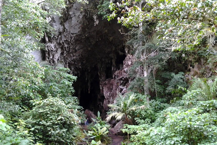
15. Cueva del Guácharo
The cave near Caripe combines limestone formations and an underground river with a living colony of guácharos, or oilbirds. These nocturnal birds make it an ecological site as well as a geological one. Alexander von Humboldt explored the cave in 1799; the cave monument and the surrounding national park are distinct protected designations. INPARQUES describes a regulated visitor route, so confirm the availability of a guided entry and follow the guide's instructions inside, rather than treating the explored cave system as freely accessible.
Guayana: the Orinoco and the landscapes of Canaima
4 places
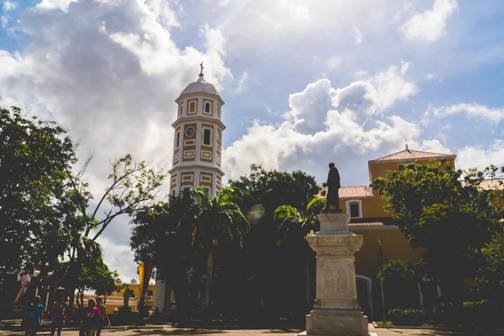
16. Historic centre of Ciudad Bolívar
Ciudad Bolívar stands on the southern bank of the Orinoco at a narrow section of the river. Its earlier name, Angostura, reflects that constricted setting, and UNESCO's tentative-list description places the old town beside it. The historic centre is a national historic monument. It introduces the urban and river heritage of Guayana alongside the region's much more remote tepui landscapes; it should not be treated as a starting point for independent travel through mining areas.
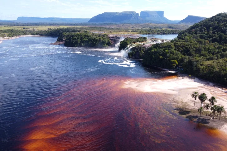
17. Canaima Lagoon
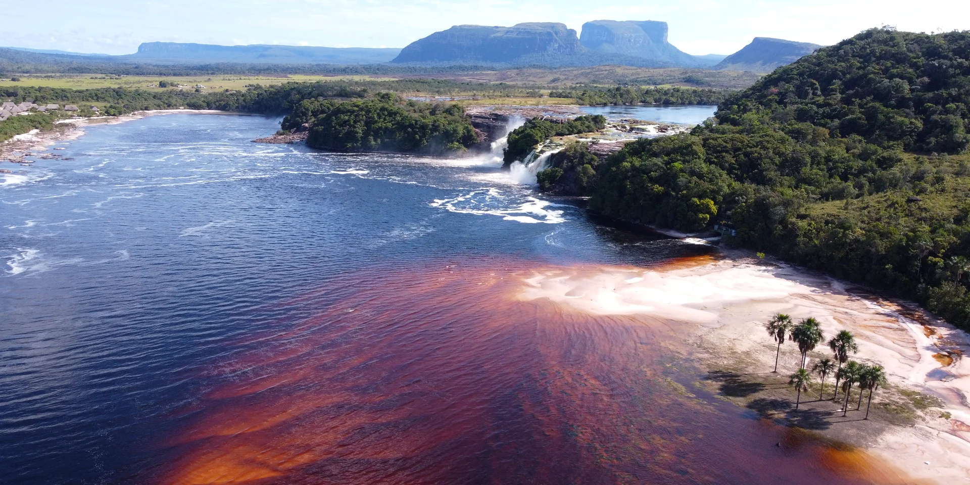
In Canaima's western sector, the lagoon combines cascades with tepui silhouettes in the background. INPARQUES associates the reddish water and pinkish sand with tannins and quartz, giving the shore colours quite different from a Caribbean beach. Hacha, Golondrina, Wadaima and Ucaima are among the falls linked to the lagoon. These cascades are separate from Angel Falls: seeing the lagoon is a different experience from making an excursion toward Auyán-tepui.
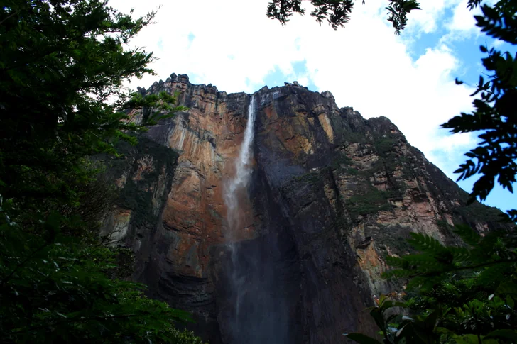
18. Angel Falls
Angel Falls descends from Auyán-tepui within Canaima National Park, a UNESCO World Heritage property. The water drops from a steep table-mountain wall into the landscape below, making the tepui setting essential to the view. Rural Bolívar is subject to strong official warnings; a river-based approach and an aerial view require different arrangements, and neither is guaranteed.
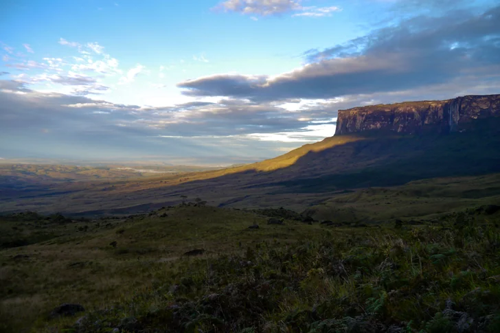
19. Mount Roraima
Roraima belongs to Canaima's eastern sector, in the Pakaraima range near the meeting of Venezuela, Brazil and Guyana. Its broad, flat quartzite summit rises above steep walls, with an isolated highland ecosystem and frequent cloud cover. It exemplifies the distinctive table-mountain landforms for which Canaima is recognised. The mountain's border location falls within areas covered by strong official travel warnings, so its inclusion here should not be read as a recommendation for an independent trek.
The Andes: Mérida and the páramo
3 places
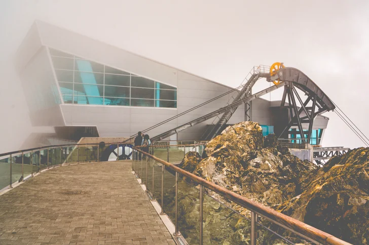
20. Mukumbarí Mérida Cable Car
Mukumbarí is Mérida's cable-car system, rising into the high Andes through a series of mountain sections. The Ministry of Tourism reported maintenance across its four sections and a restart of commercial operations in May 2026. That announcement predates the June earthquakes, so confirm the operating sections, available stations and return arrangements before buying a ticket. Weather and altitude are part of planning this excursion, and distant mountain views depend on visibility.
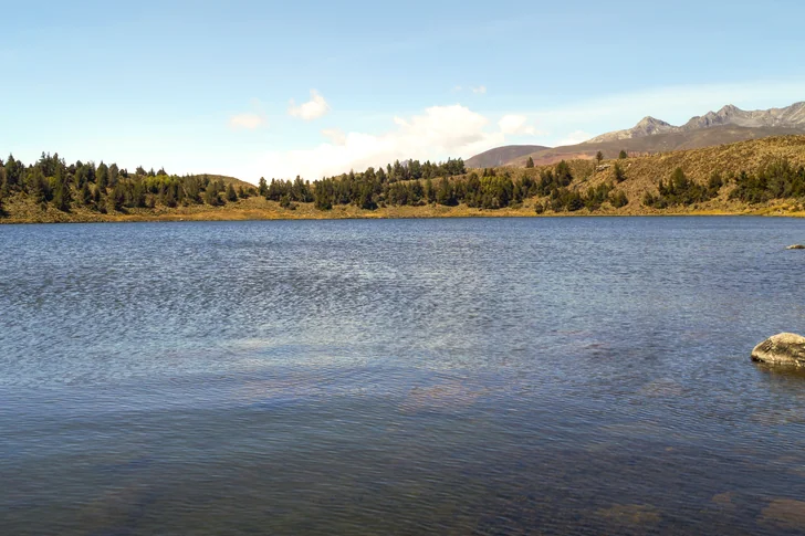
21. Laguna de Mucubají
Mucubají is a highland lake within Sierra Nevada National Park, surrounded by the páramo landscape of the Andes. Official tourism descriptions draw attention to the frailejones growing around it and the mist that can obscure the slopes. Water, highland vegetation and nearby mountain terrain form a more intimate scene than the distant panoramas associated with the cable car. Keep a lakeside outing distinct from any longer trail, whose condition and permitted route need separate checking.
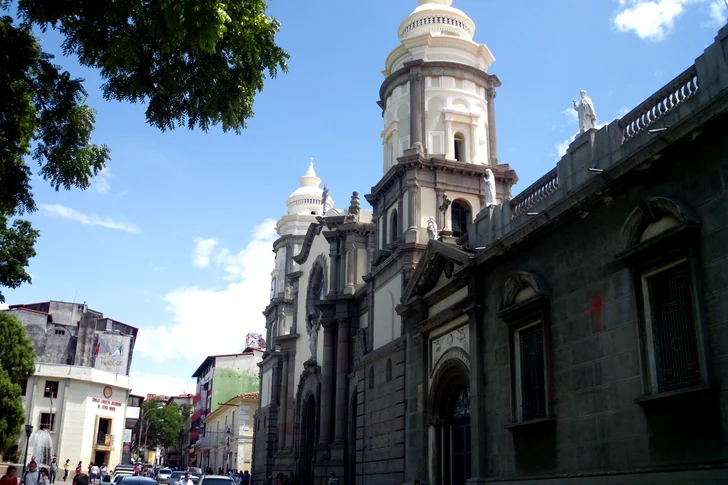
22. Mérida Cathedral
Mérida's Metropolitan Cathedral is also the Minor Basilica of the Immaculate Conception. The Ministry of Culture recognises it as a national historic monument, making it a cultural stop within a city more often associated with mountain excursions. A church visit can form part of a day kept within Mérida rather than a journey into the páramo. Confirm visitor access and respect services when arranging entry.
Zulia: Maracaibo's monuments and lake
3 places
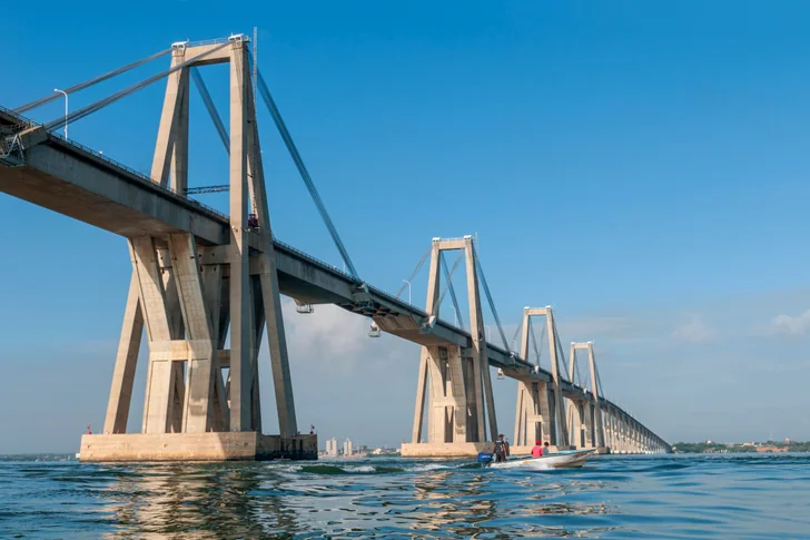
23. General Rafael Urdaneta Bridge
The bridge crosses the narrow part of Lake Maracaibo and connects the city with the wider road network. Its concrete supports and central cable-stayed spans make it a recognisable engineering landmark, distinct from the city's religious and historic monuments. It remains transport infrastructure, rather than a pedestrian attraction. Do not plan a stop on the carriageway for photographs; any viewing location and transfer should be established separately under the current restrictions for Zulia.
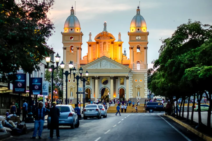
24. Basilica of Our Lady of Chiquinquirá
Maracaibo's basilica is associated with the devotion to Nuestra Señora del Rosario de Chiquinquirá, popularly known as La Chinita. It is a focus of the city's religious heritage, with the Archdiocese of Maracaibo identified as its custodian. The Venezuelan church is distinct from the similarly named shrine in Colombia. Ask the church about visitor arrangements and services; traditions surrounding the image belong to its religious significance.
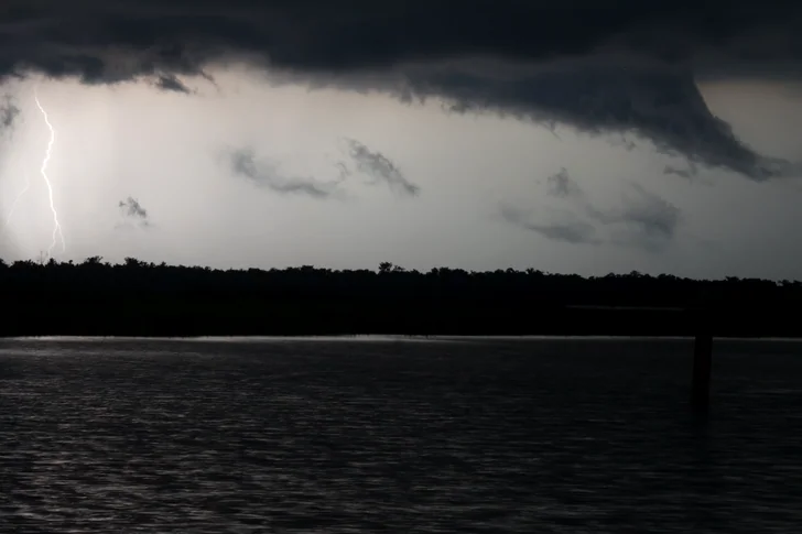
25. Lake Maracaibo and Catatumbo lightning
Lake Maracaibo is a setting for unusually frequent thunderstorms, particularly around the Catatumbo River toward its southwest. NASA explains how local winds, shaped by the mountains and the lake, converge over warm, moist air and help thunderstorms develop at night. The phenomenon changes with weather conditions, rather than following a visitor timetable. Regional and border warnings remain relevant; its inclusion is not advice to organise an independent night-time boat trip.
Local options for one, two or three days
One day in Caracas: if local conditions and visitor access permit, choose either the historic centre around Plaza Bolívar and the Pantheon, or an architecture-focused visit to UCV. Keeping one theme avoids relying on several unconfirmed opening arrangements. El Ávila can be considered as a separate alternative once park and cable-car access are established.
Two days based in Mérida: reserve one local block for the city and cathedral, with Mukumbarí only if its operation is confirmed. Use the other for a separately arranged Mucubají outing if roads, weather and park access allow. A cancelled mountain excursion should leave room for a change of plan, rather than force a longer journey.
Three days in one destination: a Margarita-based selection could divide time between La Asunción, La Restinga and Playa El Agua, subject to local conditions. Los Roques or Canaima require separate confirmed transport and programmes, allowing for arrival and departure. Roraima and Catatumbo are not short extensions to these plans.
 Russia

 France
 Montenegro
 Hungary